Watershed Protection & Remediation

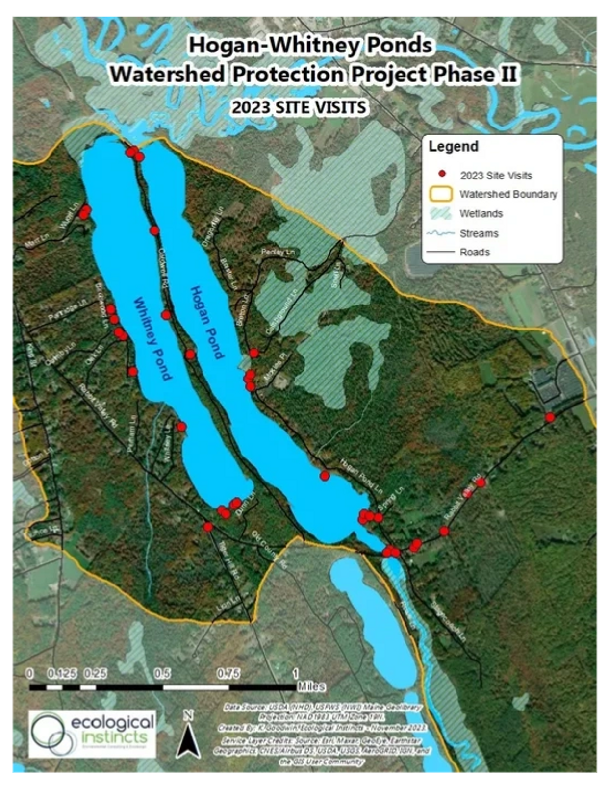
Summer 2023 Map
In 2017, the Hogan-Whitney Ponds Association (HWPA) embarked on an enhanced effort to protect the watershed of Hogan & Whitney Ponds. The ponds are listed as “threatened” by the Maine Department of Environmental Protection (DEP) due to their sensitivity to Non-Point Source (NPS) pollution. NPS pollution refers to pollution that comes from diffuse sources throughout the watershed, mostly as a result of stormwater runoff carrying excess soil and nutrients into the ponds. With the help of DEP’s technical support, we assembled a team of 25 volunteers to spend a morning getting trained by DEP staff and several other experts about how to identify sources of NPS pollution on the more than 250 properties within the watershed. Financial support for this training was also provided by a grant from Lake Stewards of Maine. That afternoon and the next day, we surveyed developed properties, documenting locations on private properties and private and public roads where soil erosion was resulting in the delivery of sediment and attached phosphorus into the ponds. The survey identified 93 sites for future remediation efforts. A copy of the full report from the watershed survey is available below.
Watershed survey
Hogan Whitney Watershed Survey Report (pdf)
Download
Survey Volunteers & Technical Leaders, 2017
This data collection effort led to the development of a 10-year Watershed-Based Protection Plan which was approved by both state and federal environmental protection agencies in 2018. The plan opened doors for us to compete for Clean Water Act Section 319 grants provided by US EPA and administered by DEP. In the spring of 2018, with the assistance of Oxford County Soil & Water Conservation District, we applied for and were awarded a two-year watershed protection grant to address problem sites identified during the watershed survey. The two-year Watershed Protection Project was conducted from January 2019 to December 2020. During that time, the Conservation District, the Town of Oxford, and HWPA volunteers worked to reduce erosion at 22 sites, keeping an estimated 131 tons/year of soil and 111 pounds of phosphorus per year from eroding into our ponds. The project also included an important community education component to educate our members about the various erosion sites and what was being done to address them. A project summary(below) describes this work.
30 erosion sites (which we have already met – see watershed map above) as well as remediate most of those sites with the adoption of best management practices. The first year of this work is documented in a tri-fold brochure. Our voluntary efforts also include enhanced education and outreach initiatives, including the development of this website.
Phase I, Project summary
Phase I, Project Summary (pdf)
DownloadSign up for our email list for updates, and more.
This website uses cookies.
We use cookies to analyze website traffic and optimize your website experience. By accepting our use of cookies, your data will be aggregated with all other user data.